
This blog post was originally published on Outdoor Trip Magazine – a travel agency that will help you turn your outdoor adventures into reality!
With 468 square kilometers, Andorra is one of the smallest countries in the world. It is situated between France and Spain in the Pyrenees region. The official language of this micronation is Catalan yet all the signs have English, Spanish and French as well. Even though Andorra is not part of the European Union, the Euro is used as the country’s currency. Many people visit Andorra for the amazing skiing and the ultra-low tax shopping, but I came to Andorra to do some hiking instead. And as a person who is keeping track of the countries visited, I was very keen to add Andorra to my list as Number 32!
While researching potential hikes for this trip, I came across three noteworthy ones that I decided to try!
Estanys de Tristaina
- Starting Point: La Coma Del Forat (N42 37.906 E1 28.930)
- Distance: 4.4km
- Difficulty: Easy
- Link to route data sheet: https://visitandorra.com/ca/content/download/8283/602723/30/file/andorra-hiking-trail-tristaina-lakes.pdf/
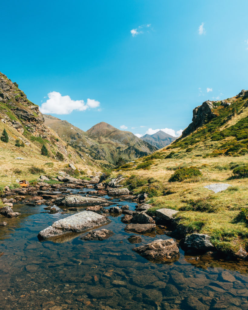
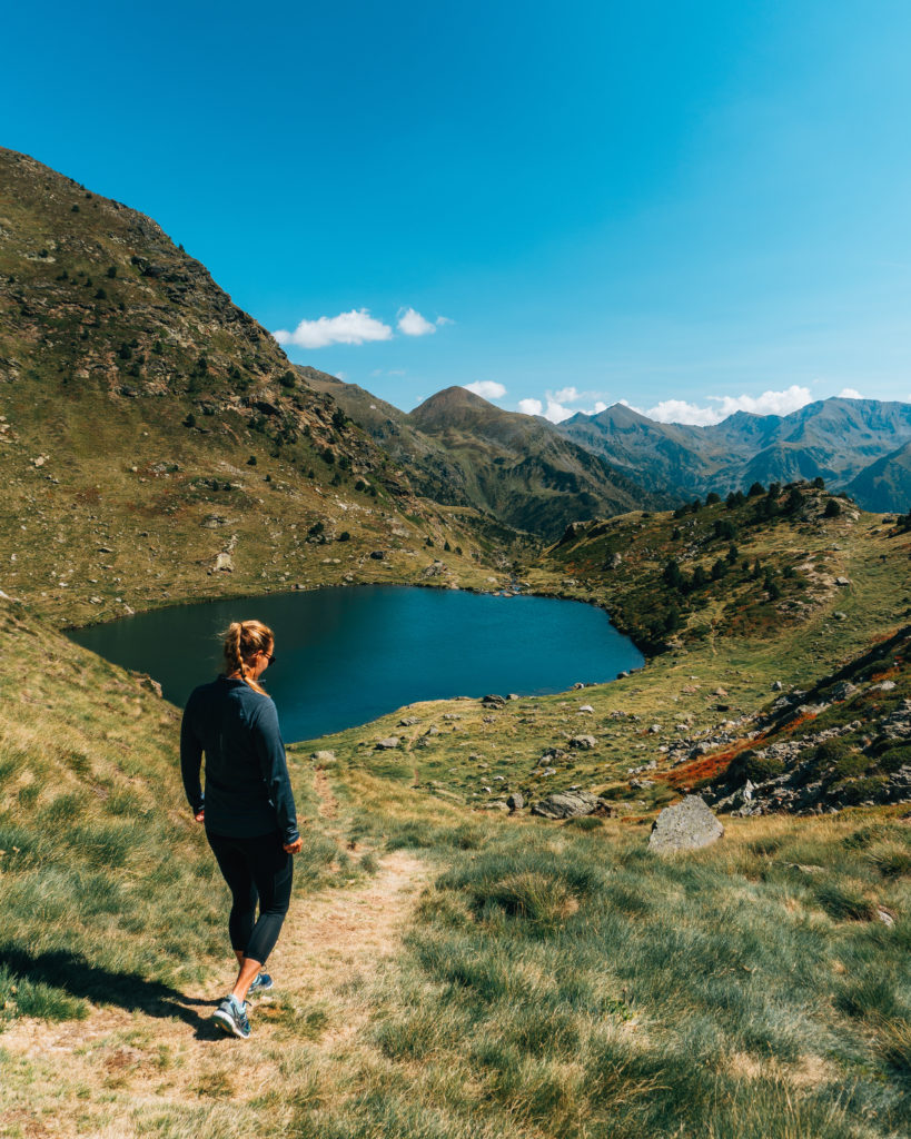
The road that leads to the starting point of this hike has been a part of the Tour de France, so driving to it is an adventure of its own. Expect lots of hairpin turns so keep that in mind if you get motion sick easily. Starting at the carpark right by the La Coma restaurant in the Vallnord ski resort, the hike up is pretty manageable. The views ahead are bound to distract you! Primer Lake, Mig Lake and Més Amunt Lake make up the Tristaina Lake trio. This circular route around the lakes is doable in 3 to 4 hours at a leisurely pace. If you are visiting Andorra during the summer, bring your swimwear along for the hike and hop into one of the deep-blue lakes to cool off. Warning: they are still likely going to be frigid!
Estany Primer de Juclar
- Starting Point: Bridge Baladosa (N42 36.122 E1 41.224)
- Distance: 9.2km
- Difficulty: Moderate
- Link to route data sheet: https://visitandorra.com/ca/content/download/586631/21906901/file/03-lake-jucla-eng.pdf/
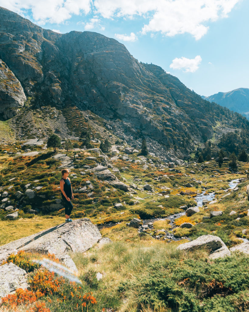
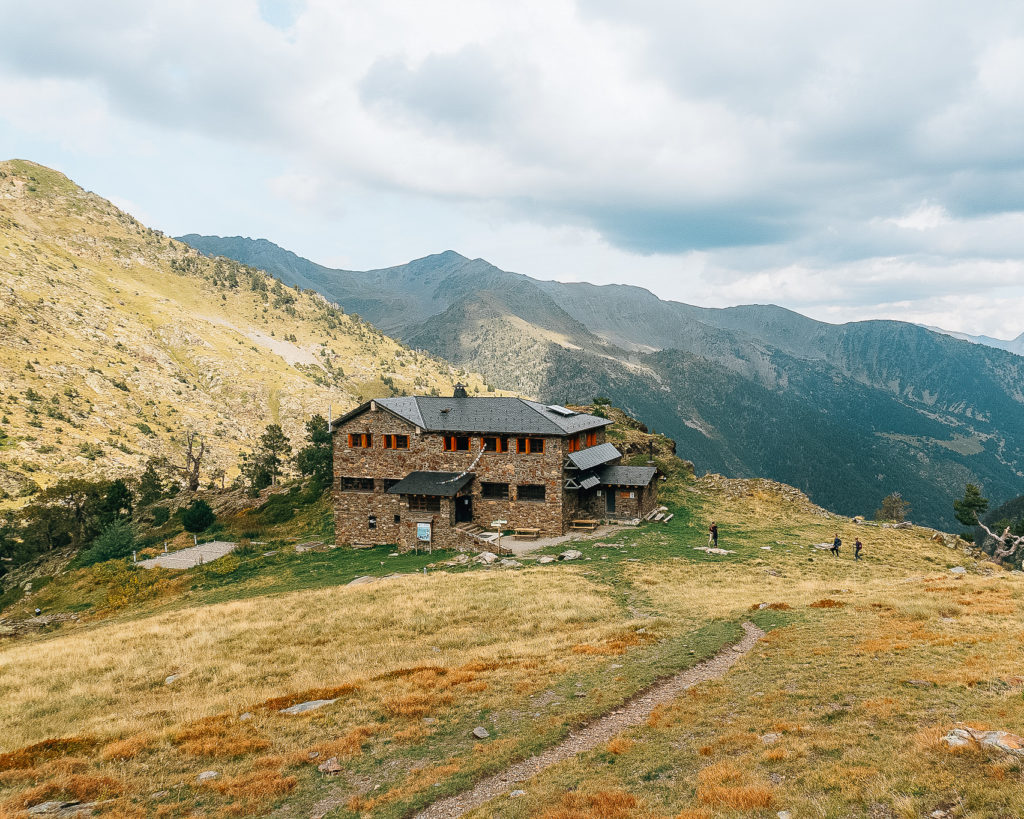
This in-and-out hike visiting Andorra’s largest lake takes off right from the car park by Baladosa Bridge at the end of the Incles Valley. It starts fairly easily as it follows a forest track but when you leave the road behind, the trail gets steeper and rockier. The demanding climb continues until you reach the Juclar plane. At 2,310 meters, you will find the Refugi de Juclar which provides accommodations for hikers and mountaineers. The refuge is located near the shores of two lakes, Estany Primier de Juclar and Estany Segon which translates to first and second Juclar lake. It’s a great stop for food and drinks if you need to reward yourself for the hike up. I was not adequately prepared for this hike, so I had a sandwich and coffee to keep me going. The whole hike takes about 5 to 6 hours mainly depending on how much time you want to spend at the refuge.
Coma Pedrosa
- Starting point: Arinsal Car Park (N42 34.409 E1 28.440)
- Distance: 15.4km
- Difficulty: Hard
- Link to route data sheet: https://visitandorra.com/ca/content/download/8304/630996/file/andorra-hiking-trail-comapedrosa-highlands-route.pdf/
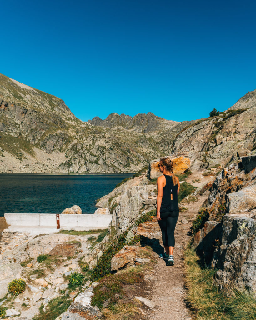
At 2,943 meters, Coma Pedrosa is the highest peak of Andorra offering a challenge for seasoned hikers. As soon as you start this hike, you’ll immediately begin climbing elevation, but don’t give up! The path plateaus for a bit following the forest track and which allows a chance for you to catch your breath. The climb continues pretty aggressively through varying terrain, which requires careful and slower maneuvering. After 3 hours of hiking, you will come across a refuge which is a great place to stop for a drink and relax. For me, the original plan was to summit Coma Pedrosa, but due to starting later than expected, I decided to turn around and head back here. The trek to the refuge and back down took about 6 hours, so start early or plan to stay overnight at the refuge if you’re ambitious enough to summit Coma Pedrosa.
I have to admit, going to Andorra was not very high on my travel bucket list but wow- what a pleasant surprise! I wasn’t expecting much since I’ve never heard anyone raving about this country before and instead, I had the best time hiking and exploring the area. The trails were very clean and well-labeled. Surprisingly by September, the crowds had cleared, and I was practically the only person on the trails. I would highly recommend heading up to this mountainous microstate to anyone who is visiting western Europe and is looking to tag on an outdoor adventure.